


Board of Tax Assessors View Pictometry Demonstration to Consider Future Pictometry Utilization
Board of Assessors, News July 17, 2019
ELLIJAY, Ga. – The Gilmer County Board of Tax Assessors Viewed a Pictometry Demonstration to Consider Future Pictometry Utilization in the County during their meeting on Monday, July 15, 2019.
Pictometry is more or less aerial imaging. It provides obliques in that it can see every structure from approximately a 45 degree angle via high-resolution images.
It views the makeup of the structure; wood, brick, the number of stories, if it’s a barn, a garage or car shed, etc.
It’s not an entirely new concept to the county, as Gilmer had its first flight in around March of 2017.
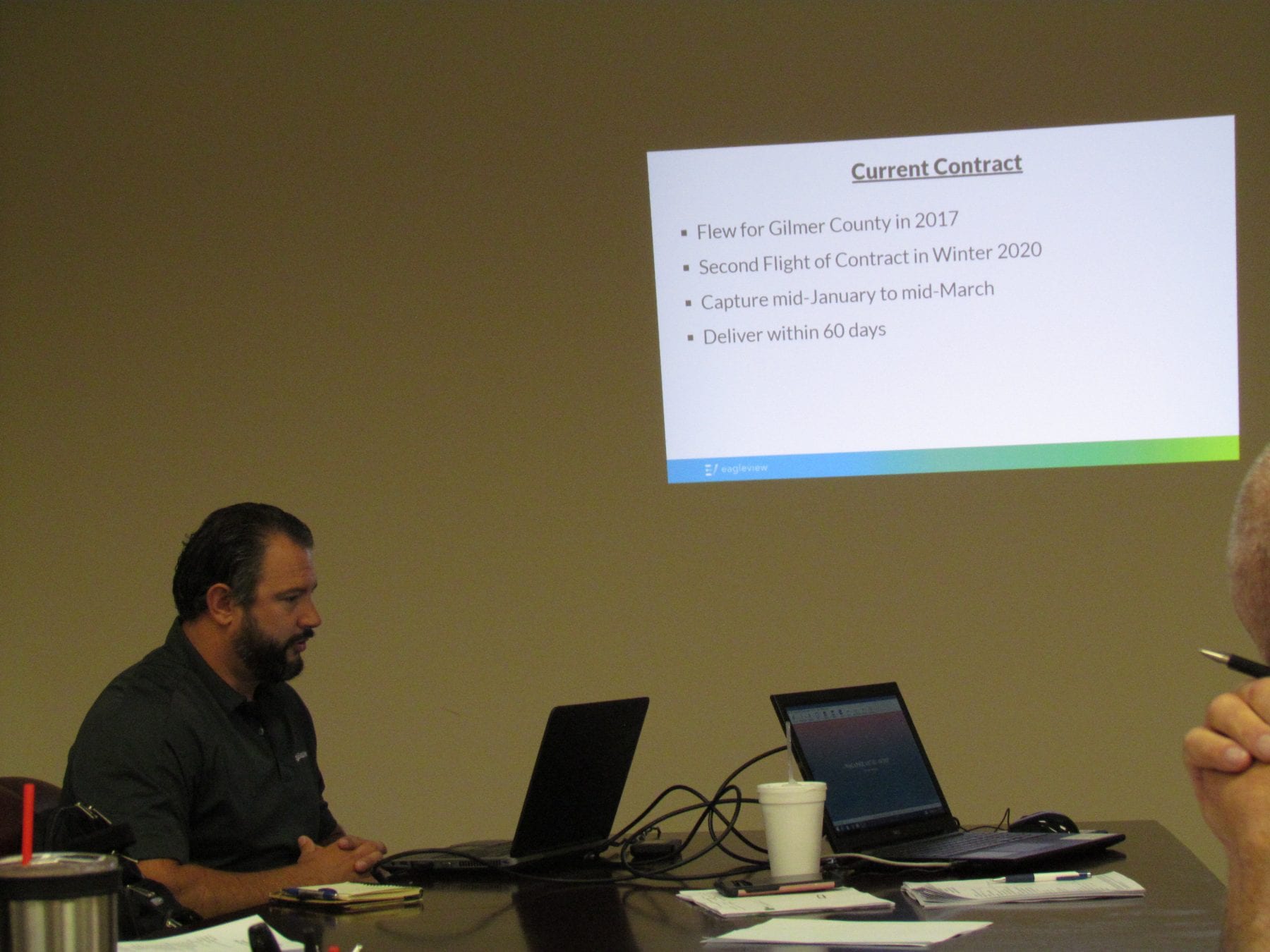
Kevin of EagleView
Kevin, a representative of the company EagleView presented a demonstration to the board pending its renewal of the county’s contract with the company.
The current contract is set to expire at the end of the year, but with the potential new contract the board is looking to utilize a technology known as “ChangeFinder”.
ChangeFinder is still Pictometry, but it’s a program that will essentially allow the Board of Assessors to quickly and easily determine any changes made to a property between the last aerial scan and the current aerial scan.
Aerial scans are made once every three years. ChangeFinder allows the board to quickly and easily compare two years of imagery, more or less.
The software can create building outlines for structures 150 square feet or greater.
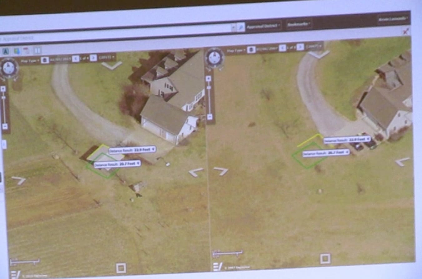
Before and after imagery with ChangeFinder
It can categorize structures as new, changed (if there’s an added wing to a building, for example), or demolished.
It can find unclaimed revenue and provide cleanup data, and can pinpoint where to send out field staff.
The software can even measure structures directly from the imagery.
The imagery is provided to the board within 60 days of it being obtained, though Kevin explains this will likely be more along the lines of 30-45 days.
The software also allows the board to potentially quickly cross-reference with other areas of the local government, such as checking with the Office of Planning & Zoning to see if a permit has been granted for certain structures.
Instead of riding the roads to find changes, this will allow the board to see if there has been a 50% increase
to square footage, for example.
According to the statistics provided, the software has enabled office staff to check 281% more parcels than the year before, field staff to check 284% more parcels than the year before, total field costs were cut by 69%, and the miles driven (per parcel) were cut by 70%.
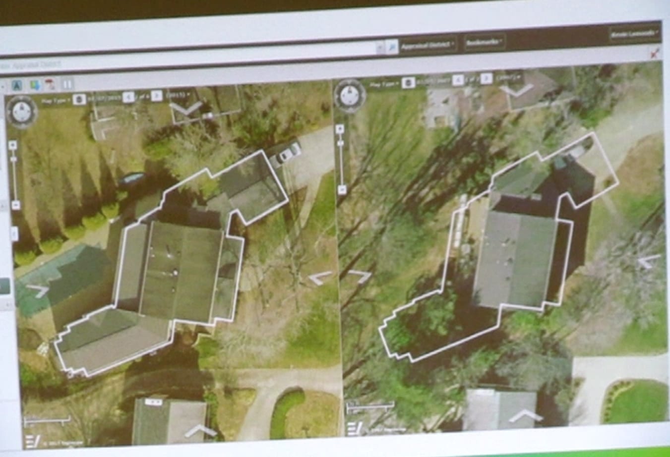
Before and after with ChangeFinder
The price for the imagery and the ChangeFinder tool would be $91,173 total (payable over three years), or, $30,391/year.
The board must renew the contract with the ChangeFinder option in order to utilize the before and after tools.
The price for just the image captures without the ChangeFinder tools would be payable over three years: $63,313 total, or, $21,104.33/year.
It is said that the revenue found from ChangeFinder usually covers the cost of ChangeFinder, if not the entire process (imaging plus ChangeFinder tools), though this can’t be guaranteed.
It will be proposed for the county budget in August, and then must go through a three month approval process.
All paperwork must be done by December in order for the Winter 2020 flight to occur, which will likely be mid-January to mid-March, depending on the weather.
Stay tuned for future developments!
FetchYourNews.com attracts more than 300,000 page views and 3.5 million impressions per month for ad server. FYNTV attracts approximately 15,000 viewers per week and has between 15,000 to 60,000 per week Facebook page reach. For the most effective, least expensive local advertising, call 706-276-6397 or visit [email protected].
Leave a comment